
Strava Heatmaps in Haiti
Last November, Strava released a feature called the Global Heatmap on their labs page. This weekend, a number of security analysts used this map to show the importance of military device security. When focused on countries like Djibouti, Syria, or Somalia, the map clearly shows Western military outposts that might otherwise be nondescript airstrips, near-impossible to find in vast desert expanses…
So much cool stuff to be done. Outposts around Mosul (or locals who enjoy running in close circles around their houses): pic.twitter.com/wHItJwYUUI
— Tobias Schneider (@tobiaschneider) January 27, 2018
This sparked a huge back-and-forth over the size of this security risk, Strava’s responsibility, and even brought back discussions that came up when satellite imagery first became popular.
My latest for the @nytimes. The Strava debacle shows that individualized "informed consent" is not sufficient for data privacy. Given the complexity, companies cannot fully inform us, and thus we cannot fully consent. Data privacy is more a public good. https://t.co/OFWAcpJvkS pic.twitter.com/vcSeRIw1G5
— zeynep tufekci (@zeynep) January 30, 2018
I decided to take a lighter look at this. Since Strava users tend to skew wealthy and Western, I centered the map on a developing country, Haiti, to see where the well-heeled and fitness-centered are using Strava.
This brought back fond memories for me. Four years ago, right after I graduated undergrad, I spent three months in Haiti. My uncle let me stay in his spare bedroom in his Port-au-Prince apartment while I helped out at his nonprofit organization and interned at a local electronics company. So I wanted to see if I could find local expat hangout spots and neighborhoods.
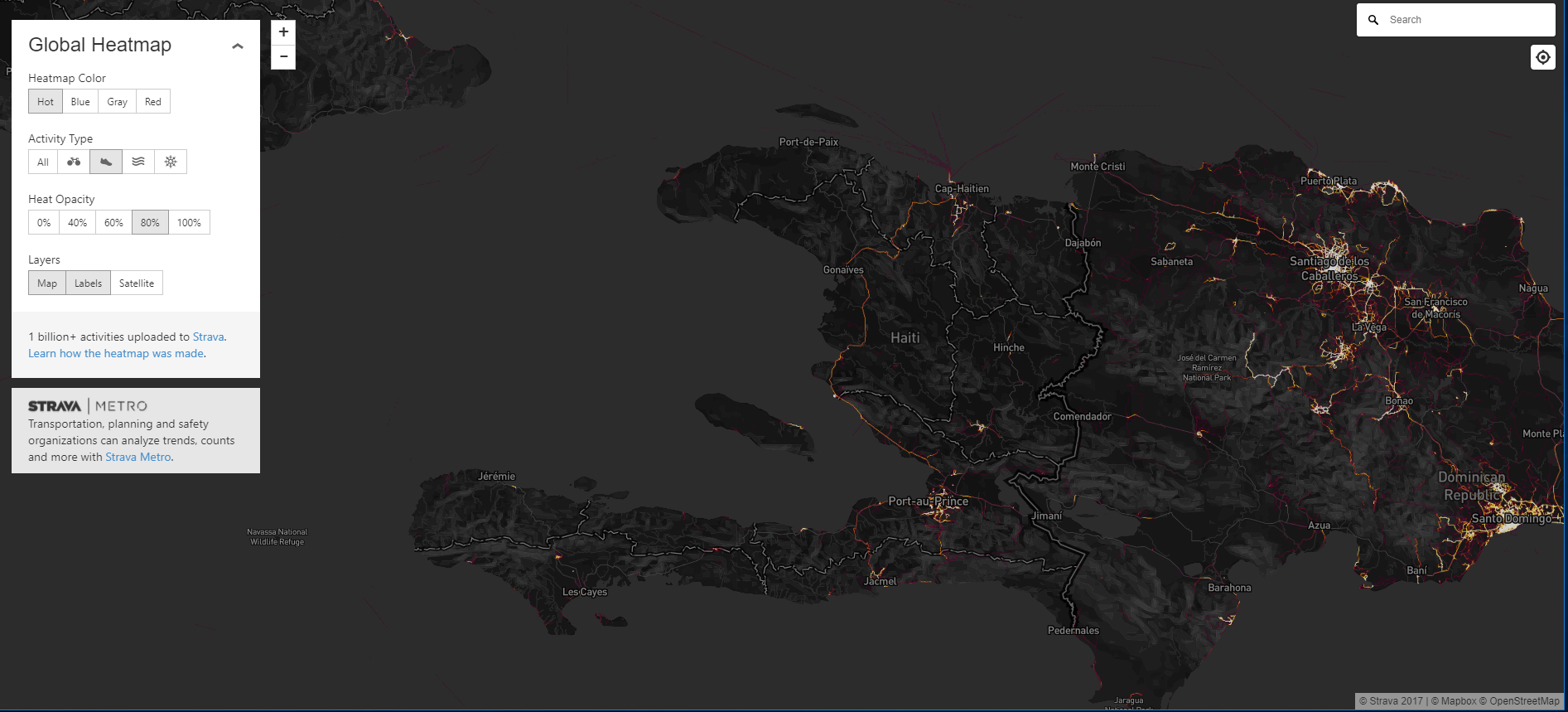
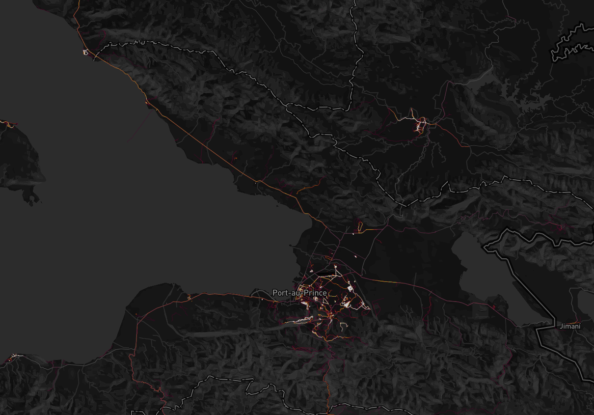
On the national map, we see Port au Prince, Haiti’s capital and largest city, shining brightest. We can also see smaller cities, like Cap-Haitien in the north, tourist towns like Jacmel in the south, and a bunch of areas that are not necessarily of national significance but are disproportionately popular with foreigners.
Tourist Spots
Labadee
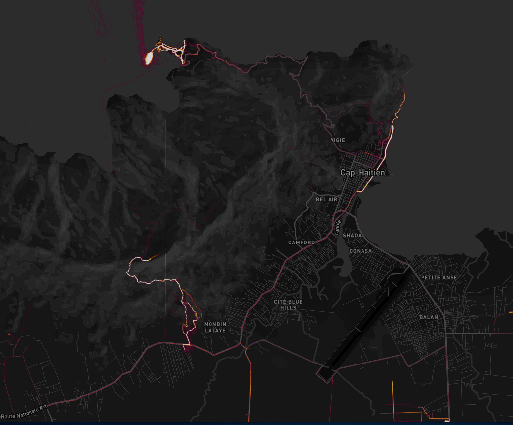
The one that sticks out the most is Port Labadee. Labadee is a private port leased by Royal Caribbean, within Cap Haitien’s arrondissement but extremely isolated from the rest of Haiti.
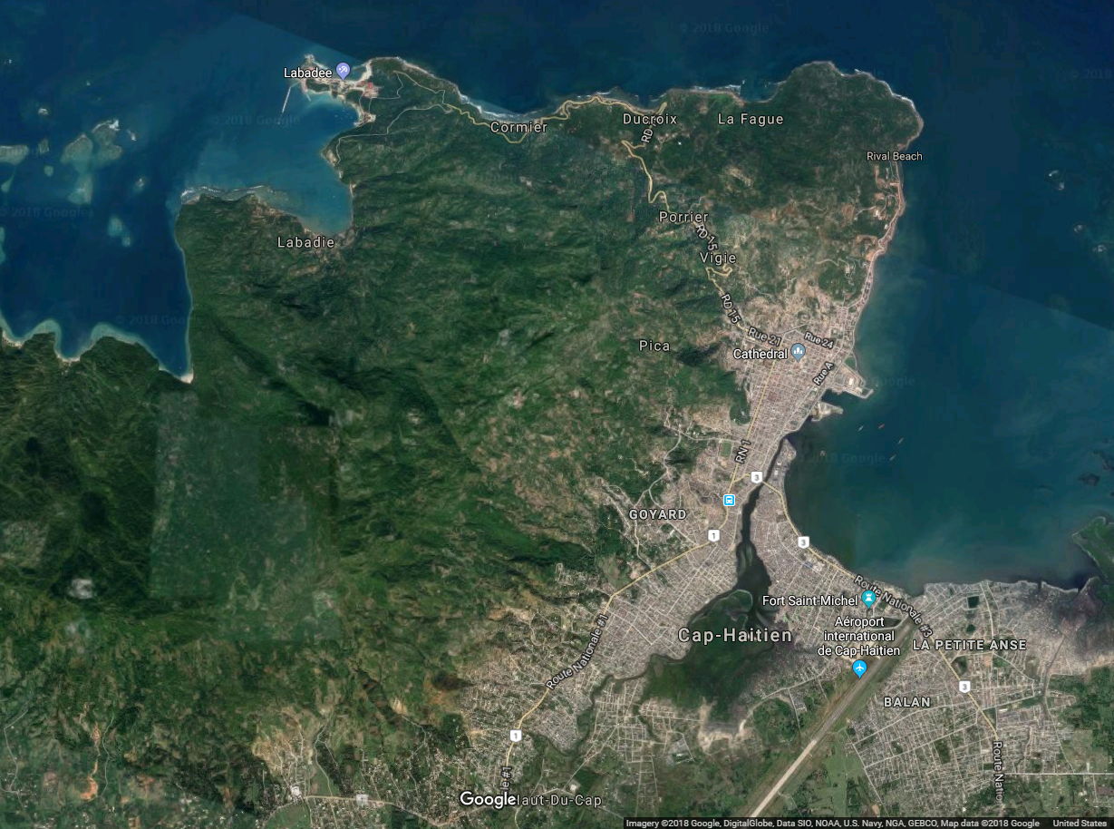
Although Labadee is barely a part of Haiti (a private security force ensures that tourists stay in and Haitians stay out), it very well might be the most popular area on Strava in the country.
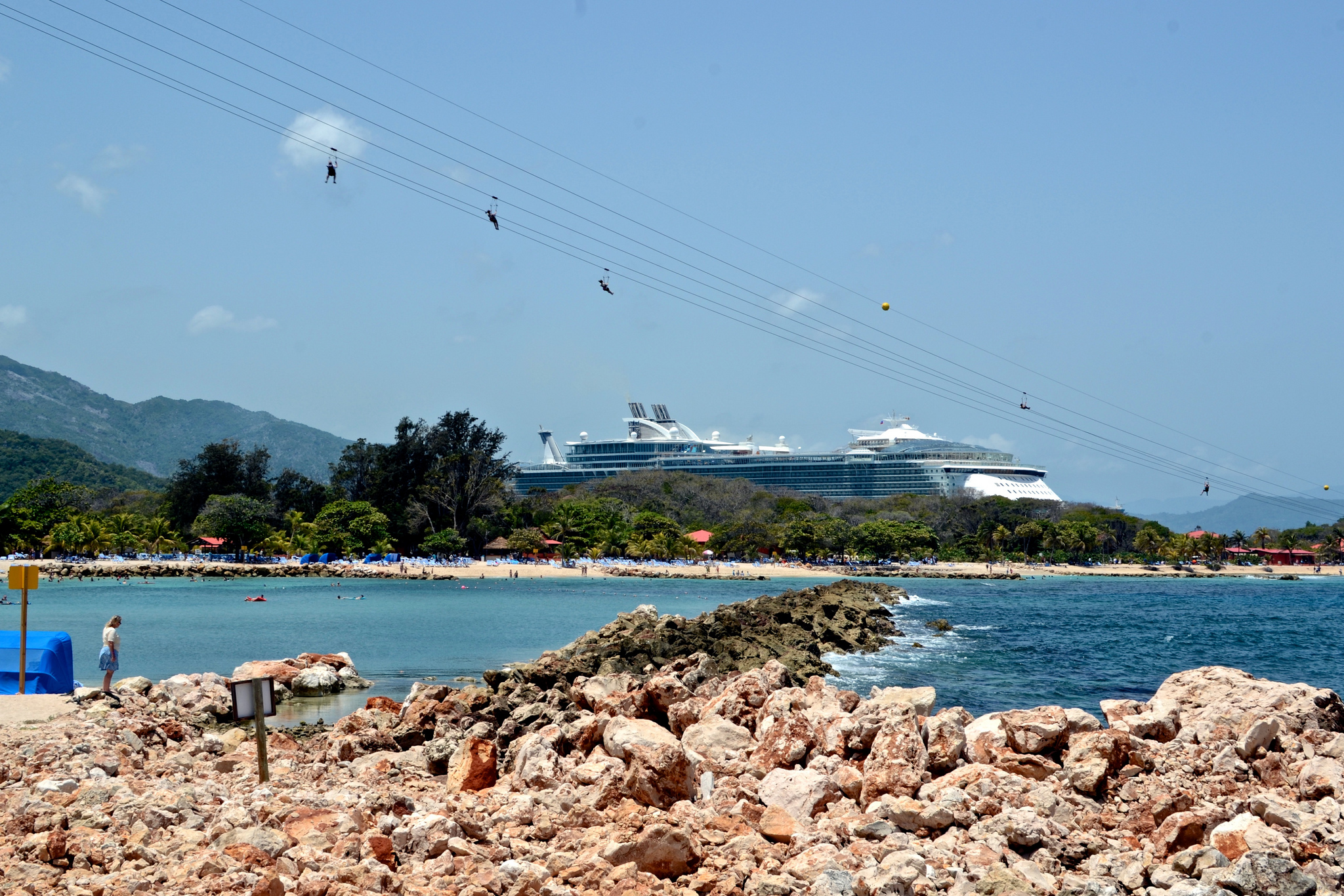
(Photo by NathanMac87 on Flickr)
Club Med
Further down the road to PAP, near the town of Montrouis, we see a small but bright spark on the map. This is on the grounds of the Royal Decameron Indigo Beach resort, formerly home of Club Med’s Haitian outpost (which closed in 1987).
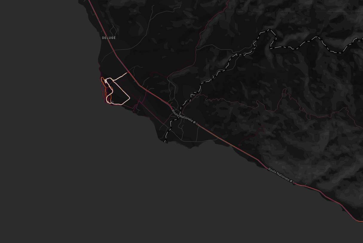
This small loop is very clearly visible, even when looking at all of central Haiti (see the bright white blip in the top-left corner)
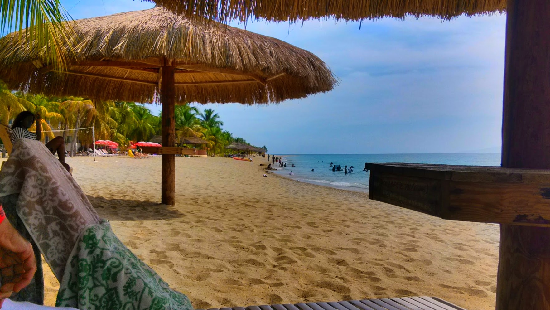
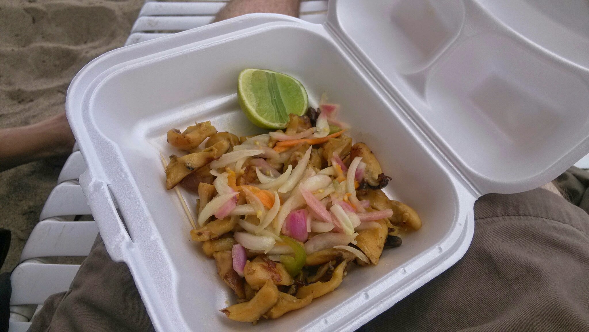
The Decameron has been operating as a resort since 2014, but when I went a year earlier, it was known as the Club Indigo, described by the Miami Herald as “a beach resort whose patrons were U.N. peacekeepers, locals and visitors from the Haitian diaspora” that “struggled even as it used just half of Club Med’s 400 rooms.” I knew that president Martelly was making a huge push towards attracting tourist chains, but at the time I was happy to enjoy the conch fritters at this quiet beach resort.
Port au Prince
Most Strava activity is focused around Port-au-Prince, a city that is almost ten times larger than any other on the island.
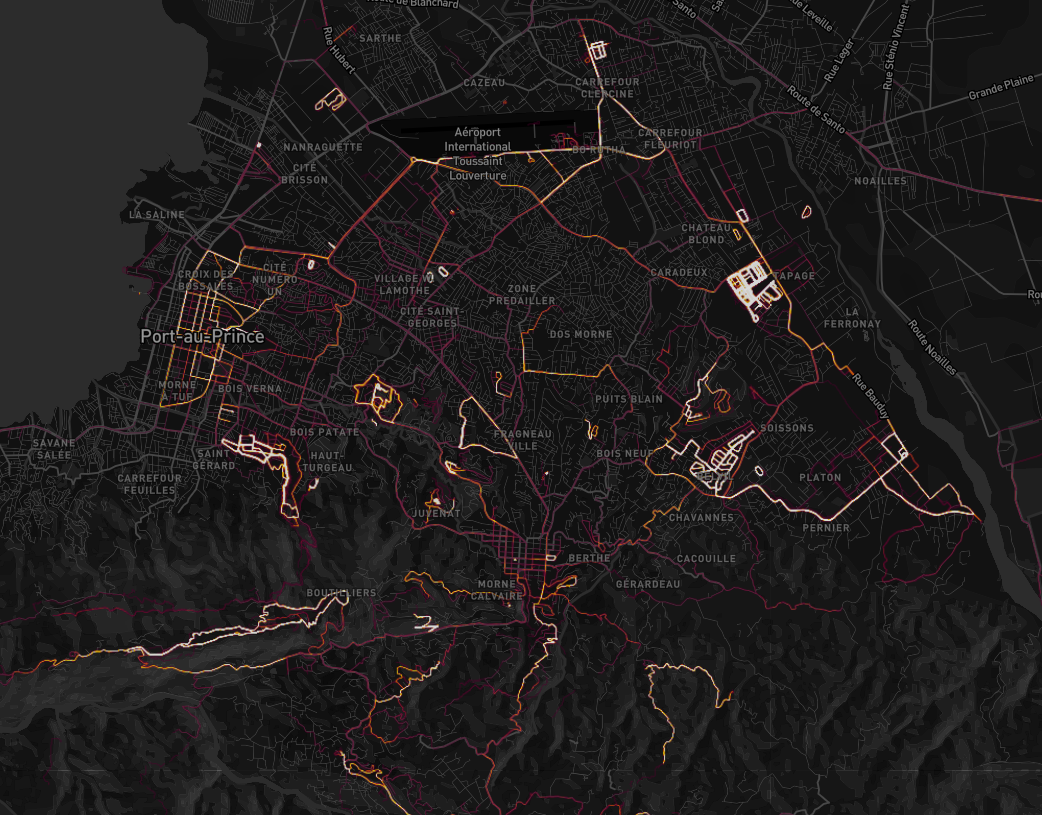
Compared to much of the Caribbean, Haiti is somewhat safe for expats. Outdoor jogging is fairly rare on the streets of Port au Prince (save for that one European woman I saw jogging on Delmas 31 at 6 PM - me and my coworkers were a bit surprised, but encouraged), so most of the running we see is in either areas of natural beauty, or secured areas. The hotspots we see are peacekeeping bases, fitness clubs, gated communities, or a few public spaces.
MINUSTAH
The security consultants pointed out military bases as large Strava hotspots in the developing world. But Haiti has no army and limited strategic importance - The mainland US is barely an hour away by plane, Guantanamo Bay is just over a hundred miles by boat, and Puerto Rico is an overnight ferry ride from the neighboring Dominican Republic. But Haiti has an immense UN presence. You can see them on the street, with their white-colored jeeps and armed patrols. Although these military forces are not deployed for war, you can still see a ton of jogging around the MINUSTAH (United Nations Stabilization Mission In Haiti, or Mission des Nations Unies pour la stabilisation en Haïti in French) bases by UN troops.
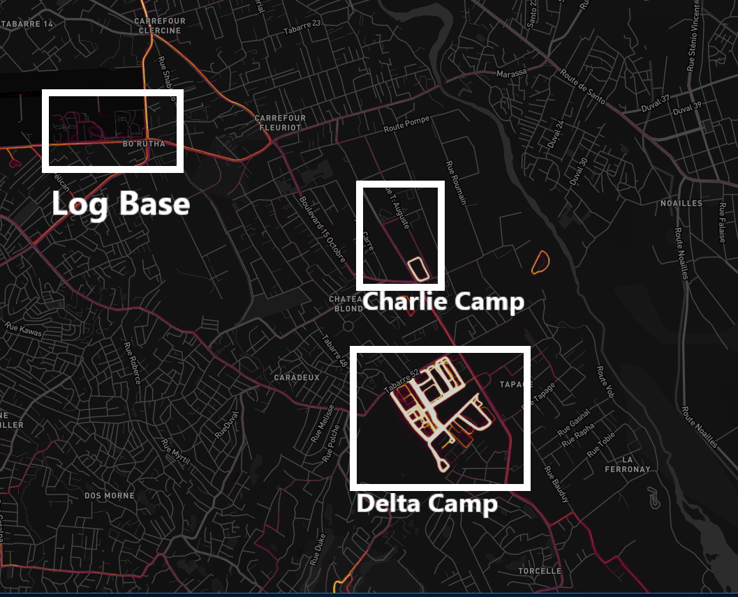
On the northern/eastern side of Port au Prince, you can clearly see “Log Base” (the logistics base for MINUSTAH’s operations, built on the grounds of the airport), “Charlie Camp”, and “Delta Camp”.
Fitness Clubs
When the earthquake struck, most of the sports arenas and fitness centers around Haiti turned into campgrounds for refugees. Google’s satellite imagery of Haiti is likely at least 6 years old, since areas that were free of camps when I was there appear tent-covered.
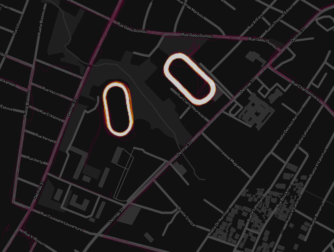
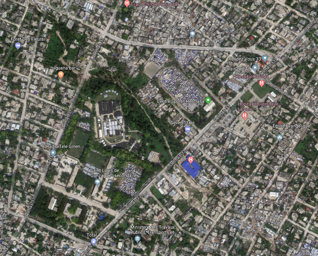
This is the Centre Sportif Henfrasa, located closer to downtown Port au Prince. The activity suggests that the tents have been cleared out for a long time.
Like most of the world, Haiti is incredibly passionate about soccer. On Saturday mornings, you can hear announcers on radios and televisions nationwide commentating European games in a tense, metered tone, dubbed over the live feeds.
My uncle came to Haiti on a 2-year contract, and his family stayed over for a school year. My cousin, a white teenager who stood 6'7 at 15 years old, definitely stuck out amongst his peers, but his outgoing nature and his love for soccer helped him fit right in. His soccer team would sometimes have games at Henfrasa.

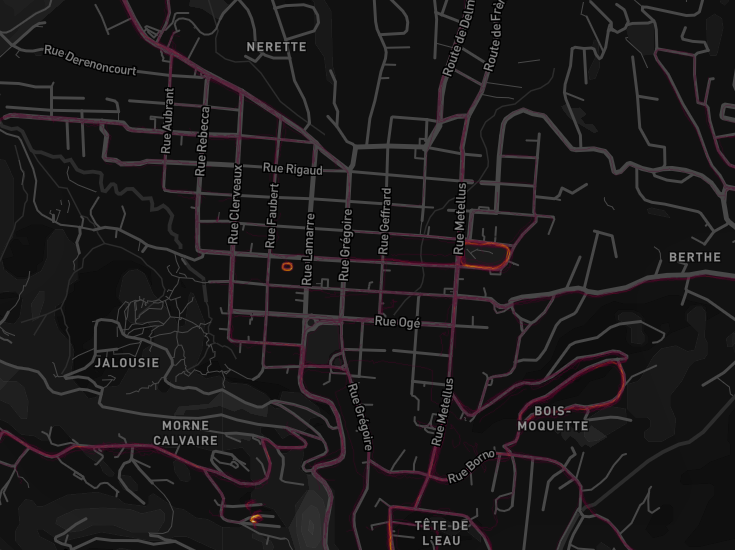
We can also see Energy Health Club, what might be Haiti’s only indoor fitness club, as a tight ring in Petionville, the upperclass Port au Prince suburb in the foothills of the Chaîne de la Selle mountain range. I spent most of my time in Petionville, where most NGOs had their national headquarters.

Gated Communities
Since most of Haiti isn’t safe after dark on foot, especially for expats, most upperclass housing comes with tall walls and a security presence. Accordingly, the few gated communities that exist are quite popular with joggers.
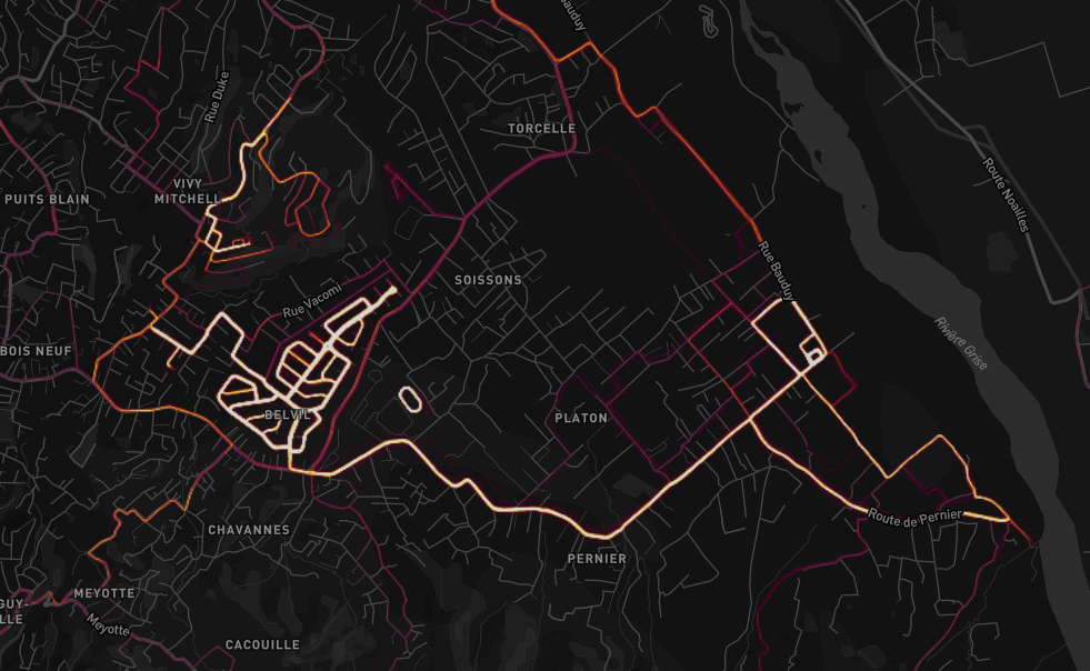
We can see Belvil, close to Vivy Mitchell (President Martelly’s house) and the Haitian National Police headquarters (appearing as a small ring south of the complex), in this map…
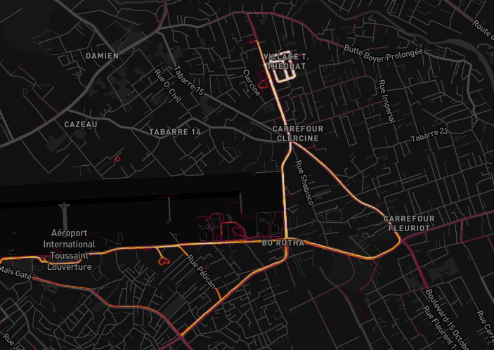
… and Village T. Theodat, a popular location for guest houses close to the airport in this map.
L’Observatoire
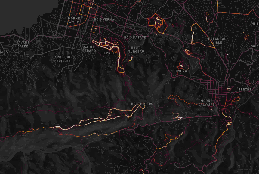
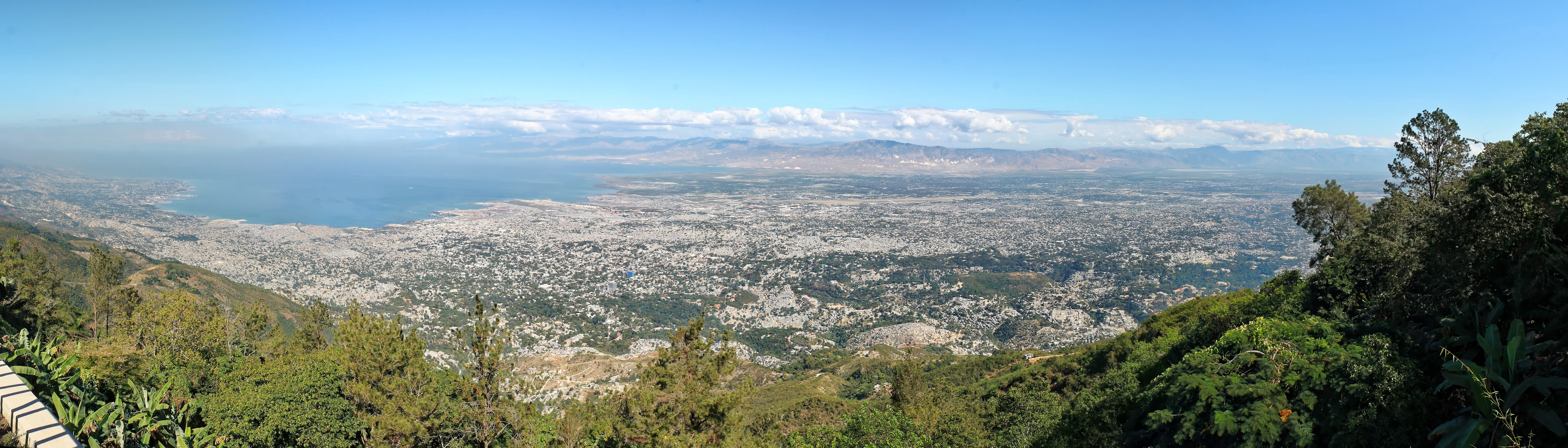
But there are a few public places that have a lot of activity. One of them is the ridge by the Observatoire de Boutillers. This popular tourist destination, set on top of Morne Boutillers, overlooks all of Port au Prince. It offers a relatively safe public road, free of traffic and close to nature.
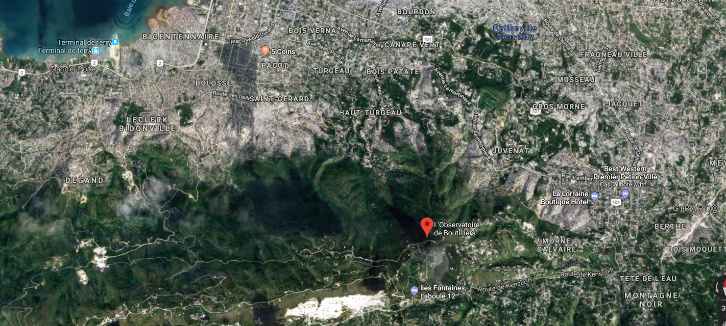
It also offers sweeping views of Port au Prince!
Haiti at a Jogger’s Glance
So while there aren’t drone bases or CIA black sites highlighted on Haiti, we still have a picture of the hangout spots of Haiti’s upperclass and expat jogger community. And I got to take a trip down memory lane looking at Strava’s data.
Until next time!